Computational Geosciences
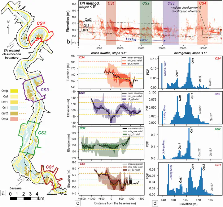
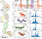
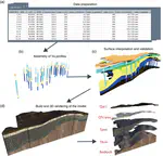
Remote sensing has emerged as a powerful technique for acquiring geotechnical and geological characteristics in a spatial-temporal manner. In CGG, we use satellite images, airborne LiDAR and related data to help solve scientific research problems related to geomorphologic change detection, geohazard assessment, site responses, and climate change topics. Our goal is to combine cutting-off sensing technology, geological/geotechnical information, and computational power to develop, test, and deliver robust solutions to geotechnical/geosciences communities.
Yichuan Zhu
Assistant Professor
My research interests inlcude granular mechanics, remote sensing and applications, uncertainty quantification, and risk assessment and management.